Hiking Donner Pass to Summit

While the summer often brings our focus to Lake Tahoe, there is some awesome hiking to be had atop Donner Summit as well. One of the most popular trails is to hike the Pacific Crest Trail southwards from Donner Pass toward Squaw Valley, but heading north on the PCT is also a lovely adventure, which packs a ton of great views and hiking in just four miles of trail.
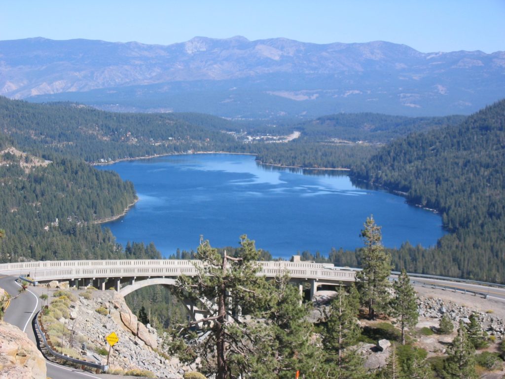
Begin your hike just at the top of Donner Pass, where Highway 40 meets the Pacific Crest Trail. Find parking on the left near the Sugar Bowl Academy. The trail begins amongst the high granite faces that are considered the best climbing around Lake Tahoe. Within just a few minutes, you will probably see climbers both above and below you testing themselves on beautiful smooth rock. You also quickly reach one of the best views of the hike with Rainbow Bridge and Highway 40 in the foreground and Donner Lake and Mt. Rose in the background.
The trail stays mostly level for a time, wandering through the lodgepole pine and red fir, with a steady series of interesting views of rocky outcroppings. In about 1/2 mile you reach a steady ascent on a set of switchbacks to the top of a ridge. Stop once or twice on the climb to marvel at the ingenuity and hard work required to build the Transcontinental railroad through solid rock and steep slopes in an area of high avalanche danger. From here, the trail follows the rocky ridgeline with gentle rises and descents. Look for some fine, tough as nails examples of hemlock, juniper, Jeffrey pines and western white pines, which are somehow able to survive in this area which faces the brunt of the Sierra winter storms.
In addition to the main trail, many hikers enjoy going off trail to wander to the west, eventually finding a series of lakes including Azalea, Flora and Angela. Exact directions to find these are impossible to give, but enjoy your wanderings and see what you find.
The Pacific Crest Trail eventually reaches a junction, with the PCT to the north going around a pond and underneath Interstate 80, and a 3/4 mile long connector link to the trailhead near Boreal Resort. You can hike this as an out and back from Highway 40 or Interstate 80, or use a shuttle and leave a car at either end.

 Trudi Lee has been selling and listing residential real estate at North Lake Tahoe for over 30 years. Her real estate philosophy maintains a meticulous attention to the needs of her clients…